
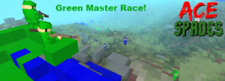
Normandie
What is it?
Normandie is a map depicting a squad-sized engagement between the allies and the axis in the days after the famous D-Day Landings. A small town set on a crossroad is the focal point of the map, with cornrows and hedges providing flanking opportunities. A large, Norman church modelled loosely on the church at Ste.-Mère-Église provides a pivotal area for both teams to fight over.
____________________
Download Here [v1.4]
Normandie Para - Click for details
____________________
Images:
Isometric Render (courtesy of Dany0):
http://i.imgur.com/kHrx2.png
[Note: The following images were taken during production and do not reflect final content]
Windows:
http://i55.tinypic.com/2h37tjr.png
Wheat Fields:
http://i56.tinypic.com/4lgccx.png
Church:
http://i51.tinypic.com/2cqfloo.png
Street:
http://i51.tinypic.com/33jtlpz.png
Archways:
http://i52.tinypic.com/2chncxc.png
Gardens:
http://i51.tinypic.com/2ytxqi9.png
Church Tower Views:
http://i53.tinypic.com/2zzp8xc.png
Hedgerows:
http://i51.tinypic.com/x43qqq.png
Manor House:
http://i56.tinypic.com/j7rxiq.png
New Ace of Spades Forums: http://buildandshoot.com/
[MAP] Normandie v1.4 & Normandie Para
13 posts
• Page 1 of 1
[MAP] Normandie v1.4 & Normandie Para
![]() by Influx » Thu Jan 12, 2012 11:22 pm
by Influx » Thu Jan 12, 2012 11:22 pm
Last edited by Influx on Sat Aug 18, 2012 2:34 am, edited 2 times in total.
-

Influx - Member
- Posts: 115
- Joined: Thu Jan 12, 2012 11:05 pm
- Location: Not France.


Re: [MAP] Normandie v1.4
![]() by SeriousSimFR » Thu Jan 19, 2012 2:25 am
by SeriousSimFR » Thu Jan 19, 2012 2:25 am
Was, Is and Will ever be one of the best AoS map.
**** <- Click ! ->
Yet Another AoS MAP : DECK 17****EPIC UNREAL TOURNAMENT SKIN PACK
 -------------------------
<- Click ! ->Yet Another AoS MAP : DECK 17****EPIC UNREAL TOURNAMENT SKIN PACK
-------------------------
-

SeriousSimFR - Member
- Posts: 92
- Joined: Sun Jan 01, 2012 6:44 pm
- Location: France
Re: [MAP] Normandie v1.4
![]() by Ultrayoshi49 » Sun Jan 22, 2012 12:21 am
by Ultrayoshi49 » Sun Jan 22, 2012 12:21 am
This has always been my favorite map.


[21:31] <+fLaMeOnCrack> Tell DE I'm sorry for insulting his greatness and if allowed, I would be happy to kiss his ass
-

Ultrayoshi49 - Komrade Member
- Posts: 469
- Joined: Thu Dec 29, 2011 9:03 pm
- Location: Chilling outside the gates of Tartarus
Re: [MAP] Normandie v1.4
![]() by estavos » Sun Jan 22, 2012 3:52 pm
by estavos » Sun Jan 22, 2012 3:52 pm
This is my favorite map!!! Author you rulezzzzz!
- estavos
- Member
- Posts: 12
- Joined: Thu Jan 12, 2012 11:30 am


Re: [MAP] Normandie v1.4
![]() by Influx » Fri May 18, 2012 6:05 pm
by Influx » Fri May 18, 2012 6:05 pm
Happy birthday, Normandie. Who'd have thought it's been a whole year since I first let this crap loose on the public?
I would do something special to mark this occasion, but I've got nothing.
*toot*

I would do something special to mark this occasion, but I've got nothing.
*toot*
-
Influx - Member
- Posts: 115
- Joined: Thu Jan 12, 2012 11:05 pm
- Location: Not France.
Re: [MAP] Normandie v1.4
![]() by Articsledder » Sun May 20, 2012 1:20 am
by Articsledder » Sun May 20, 2012 1:20 am
Influx wrote:Happy birthday, Normandie. Who'd have thought it's been a whole year since I first let this crap loose on the public?
I would do something special to mark this occasion, but I've got nothing.
*toot*
It's a shame it doesn't get much TC play, it is tons of fun with Tc and TOW
aend tehn teh cahirs began to snip
-
Articsledder - Member
- Posts: 818
- Joined: Tue Dec 27, 2011 2:55 am
- Location: New England
Re: [MAP] Normandie v1.4
![]() by Influx » Tue May 22, 2012 6:42 pm
by Influx » Tue May 22, 2012 6:42 pm
Articsledder wrote:Influx wrote:Happy birthday, Normandie. Who'd have thought it's been a whole year since I first let this crap loose on the public?
I would do something special to mark this occasion, but I've got nothing.
*toot*
It's a shame it doesn't get much TC play, it is tons of fun with Tc and TOW
I've only played it on TOW once, and not to toot my own horn or anything, but that was crazy fun. I'd imagine Market Garden would be similarly good with TOW, but I've never been able to try it.
-
Influx - Member
- Posts: 115
- Joined: Thu Jan 12, 2012 11:05 pm
- Location: Not France.
Re: [MAP] Normandie v1.5
![]() by Influx » Sat Aug 18, 2012 2:33 am
by Influx » Sat Aug 18, 2012 2:33 am
Well, talk about necro'ing a topic - but it's all for a good(-ish?) cause.
I've recently been working on a parachute script and I've implemented it on Normandie. Bear in mind I'm not really a coder so it might be sloppy and it might not be functional, but that's why I'm releasing an updated version of Normandie, so it can get a bit of a test.
There are minor changes to the map, I fixed a few odd stairwells that forced you to crouch to go up them (the one in the church is still a bit iffy, though), and added flags to the outside of the manor house.
I'm not sure exactly how this will change the map dynamic - greens now spawn all around the village whilst blue spawn inside it, meaning blue have a more concentrated force but must watch all sectors. With a bit editing, I imagine it could make for an interesting infiltration map.
Let me know what you think, or indeed if it works.
NORMANDIE PARA - PYSPADES ONLY
http://www.sendspace.com/file/dw574s
-
Influx - Member
- Posts: 115
- Joined: Thu Jan 12, 2012 11:05 pm
- Location: Not France.
Re: [MAP] Normandie v1.4 & Normandie Para
![]() by EssigGurkenFred » Mon Aug 20, 2012 11:45 am
by EssigGurkenFred » Mon Aug 20, 2012 11:45 am
One of the greatest maps ever! :)

-

EssigGurkenFred - Member
- Posts: 1370
- Joined: Tue Jan 31, 2012 6:47 pm
- Location: At Home
Re: [MAP] Normandie v1.4 & Normandie Para
![]() by jojoestinky » Fri Aug 24, 2012 8:49 pm
by jojoestinky » Fri Aug 24, 2012 8:49 pm
Very Creative, i love all the different places. I get lost a lot when i play, and I like lots of distinct places to find my way.
-

jojoestinky - [C.H] Member
- Posts: 171
- Joined: Sat Jul 21, 2012 9:26 am
Re: [MAP] Normandie v1.4 & Normandie Para
![]() by whitehot » Tue Sep 04, 2012 7:26 pm
by whitehot » Tue Sep 04, 2012 7:26 pm
One of the only non-gen maps that is best with TC.

I'm on fire. Watch out or you'll get burned.

-

whitehot - [SPQR] Member
- Posts: 19
- Joined: Thu May 03, 2012 1:40 am
- Location: USA
13 posts
• Page 1 of 1
Who is online
Users browsing this forum: No registered users and 2 guests